
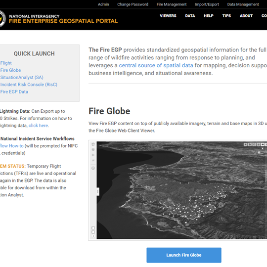
NIFC Enterprise Geospatial Portal Suite and ANF Pre-Attack Platform
DSoft Technology supports the National Interagency Fire Center (NIFC) with project management, design, development, programming and system administration of the Enterprise Geospatial Portal (EGP), a suite of web-based applications for coordinating wildland fire fighting efforts at the national level.
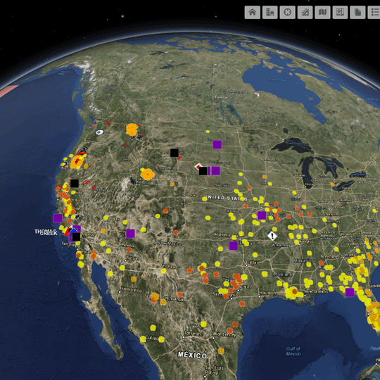
The custom-built FLIGHT module within EGP simplifies the otherwise complex coordination and cost capture of federal and contract airborne firefighting resources. FLIGHT facilitates a life cycle resource data entry capability by field managers, real time information query by stakeholders, and long term warehousing of data for research and analysis.
Lightning Viewer ingests Bureau of Land Management lightning strike data to enable predictive services as well as post-incident fire investigation forensics.
•Enable FAM to control fires in a coordinated manner: “When a response to wildfire is necessary, the Forest Service will work to control fires in a coordinated manner that is safe, efficient, and cost effective in order to retain healthy, resilient forests and grasslands while bolstering thriving communities.”
•Enable FAM to provide science-based software to assess fire risk: “Our fire managers use science-based software to help them assess fire risk. Using the latest tools, we decide when and where to suppress a fire and when and where to use fire to achieve our objectives for long-term ecosystem health and resilience.”
•Enable FAM to evaluate the impact of action: “We will make sure that the actions we take, whether to use fire or control fire, are socially, economically, and ecologically sustainable.”
•Enable FAM to safely use firefighters and other assets: “Respond to fires based on a protocol for managing risk, leading to a safe, efficient, and effective use of firefighters and other assets.”
•Enable FAM to build effective partnerships with internal USDA, external agencies, external commercial entities, and international partners at all levels: “Build partnerships at all levels to reduce risk from wildfires by managing for healthy forests and grasslands and making communities safer when a wildfire does occur.”
•Enable FAM to incorporate improved technology: “Continually review the fire program to incorporate improved technology and to develop more efficient and cost- effective fire management techniques and processes.”
- Website Development
- Project Management
- IT Enterprise Services
- Data Analytics and Visualization
United States Forest Service
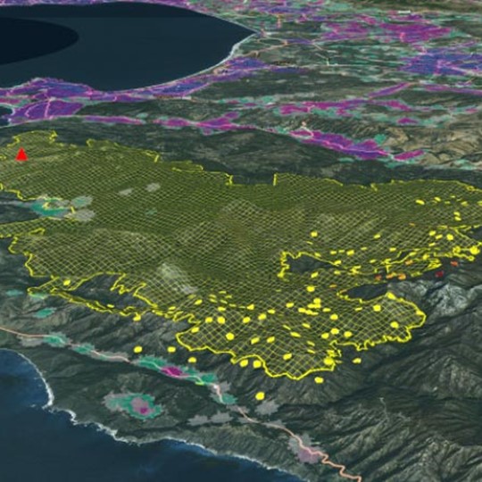
Through the operational use of the app we have been able to rapidly assess protection responsibility and values at risk. Additionally, the app has enabled us to share a common operating picture amongst responders of operational preattack information such as fuel breaks and indirect dozer lines.